Sunday, August 27, 2017

Ghosts of Arizona Route 66 and the Santa Fe Transcon - Part 2

In my last installment, I briefly introduced you to Route 66 and my first real encounter with the famed highway.  In this part, we will cover the stretch between Kingman and Seligman, Arizona.


On August 19, 2014, we woke up from our room at the Hilltop Motel in Kingman, AZ to embark on the next piece of Route 66.  The Hilltop is typical of motels of the 1950s and 60s and really speaks to the essence of what travel was like before the advent of the interstate highway. 
The main sign at the HillTop Motel.  The motel is the very essence of post-
World War II highway travel, simply constructed, minimally appointed but
most importantly, easily accessible.
Here we see part of the motel itself.  That is my white Expedition in the corner
since that is where our rooms were.
Ours was the room on the left, while my dad's was on the right.  Yes, there
was a door between rooms on the inside as that was popular during the 1950s
for travelers who took extended family along for the trip.  One could visit
between rooms without having to go outside during bad weather.
 Leaving the motel, our first stop was at the Power House Visitors Center and Route 66 Museum.  The building began life as, you guessed it, a power plant.  Built by Desert Power and Water Company in two phases between 1907 and 1911, it supplied power to a fledgling Kingman as well as a number of local mines and was powered by coal.  There was a spur from the Santa Fe main on the north side of the building that ran to the south side of the building as seen in this photo inside the museum.
Early photo of the Kingman Power House when it was still in service.  It was
closed in the late 1930s when the Hoover Dam was completed since hydro-
electric power was so much cheaper to produce.
It also provided power to the Boulder Dam project (most know it today as Hoover Dam).  Upon completion of the dam, it was determined that the electricity from the dam was cheaper to produce so the Kingman power plant was deemed surplus and closed.  The building was renovated and reopened as the museum/visitors center it is today in 2001 and is a must stop for anyone with a passing interest in Route 66 and Kingman. 
That's a lotta threes!  As indicated by the sign, the bolt it points to has a curious
claim to fame.
Continuing on from Kingman, we don't have far to go before we stumble on our next roadside attraction, Giganticus Headicus, which was created in 2003 and 2004.  Located at the old Kozy Corner Trailer Park, it has been a favorite of travelers who frequently stop to take pictures at this oddity in the Arizona desert.
Me and my family at Giganticus Headicus.
We continue east headed for the old town of Hackberry.  Just a couple of miles before the town, I spotted one of the old stone culverts that the Santa Fe built when they were laying the first rails through this area, with what I believe is the milepost location written on the arch.
Stone culvert dating from the original construction of the route through here.
As we come into Hackberry proper, there really isn't much aside from the General Store which thrives as a rest stop and photo op for tourists.  There is an eclectic mix of stuff around the property that makes for many an interesting photo.
Hackberry General Store
Across the road from the store, the old Santa Fe water tank still proudly displays it's heritage for all who care to notice while at the bottom of the hill from the store and just to the west sits a bridge over a wide dry wash also letting visitors know who put it here.

Santa Fe water tank across the road from the Hackberry General Store.
I wandered down a dirt road to explore the railroad a little and found this
bridge.  Luckily, I wouldn't have to wait long to see a train as there was a
westbound train coming just as I stopped to check things out.  Here we see
the tail end passing by.
Better view of the bridge over the wash.  Look at the pier and you can see the
difference in the construction materials.  I forget when this line had a second
track built, but it is obvious that it was the closer one that was built later.
After the train went by, it was time for us to move on as well.  As we headed east, we came upon the near ghost town of Valentine.  There was a two-story brick building here that was build as a school for the local Indian population.  The school was opened in 1901 and only operated until 1937.
Hualapai Indian Boarding School, Valentine, AZ
Traces of the Santa Fe can be found here as well.
Just in case you thought that dirt road was the interstate.
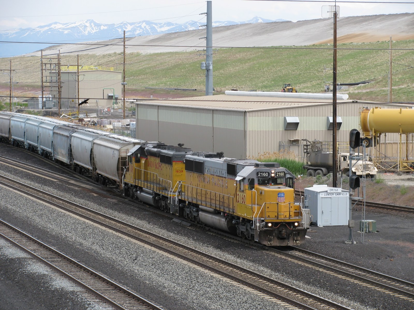
BNSF eastbound train waiting for a signal to proceed.

Delivered to BNSF in Santa Fe Warbonnet dress, this was among the
locomotives waiting to power their train east.
This westbound train was waiting for a new crew to finish taking the train to
its destination.
The railroad through Valentine follows the road pretty closely, but not for very long.  Valentine, at least for the railroad, marks the western end of Crozier Canyon and it is only a couple of miles east of Valentine that the road and the railroad split.  The old highway takes to the high ground into Truxton and Peach Springs, the headquarters of the Hualapai Indian Tribe.  Here, the tracks and the highway briefly rejoin before splitting up again at the east end of town.  Named for the abundance of peach trees surrounding the spring providing water for the locomotives, Peach Springs was established  in 1883 as a division point on the Atlantic & Pacific Railroad (later absorbed by the Santa Fe Railway).  By 1887, a post office was established and the town began to grow.  By 1907, the Santa Fe moved the division point to Seligman and the town began to fade.  That is until the push for better roads started in earnest around 1910.  The town began to prosper once again and by 1926, the National Old Trails Road was incorporated into Route 66.  The town enjoyed moderate prosperity until Interstate 40 bypassed this portion of the highway.  While the town isn't totally abandoned today, the effects of the interstate can clearly be seen in the condition of many of the old buildings.  There is somewhat of a third life for the town, however, as Peach Springs is now the gateway to the west rim of the Grand Canyon and as mentioned before, the operating center of the Hualapai Tribe.
The westbound signals in Peach Springs, AZ.
After Peach Springs, the last major attraction before reaching Seligman is Grand Canyon Caverns.  Anyone traveling old Route 66 really must stop here and tour the caverns.  Outside, there is an old gas station and motel with several old vehicles on display.  Go a little deeper into the property and you find yourself at the restaurant and gift shop.  It is here that you can acess the caverns, but not without a ticket and tour guide.  As for the caverns themselves, they are the largest dry caverns in the US and extend up to 300 feet below ground.  The conditions in the caverns are so perfect, the US government stored emergency supplies here during the Cold War and remain unspoiled to this day.  The temperature remains a constant 56 degrees and remains at 0% humidity year round.  There is a mummified bobcat that is believed to have died around 1860 and the skeletal remains of a prehistoric giant ground sloth were found in the caverns.  The sloth had apparently fallen in and tried to get out, but was unsuccessful.  There are claw marks on the cavern walls and there is a life-sized replica of the sloth as it would have appeared at the spot it was discovered.  There was even a piece of the sloth's claw found embedded in the cavern wall!
Herbie lives at Grand Canyon Caverns!
Thermometer showing the constant, year round temperature
in the caverns.
Perfectly preserved in the location it was found.  It is believed that the animal
suffered a number of broken bones after falling into the cavern and that is why
it died here.
Replica of the giant sloth based on the skeleton that was found at this spot.
Look above the sloth to see the claw marks on the wall from the claws of this
beast.
Just outside the restaurant/gift shop at Grand Canyon Caverns.
Leaving the caverns, our next stop would be Seligman.  Seligman was a division point on the Santa Fe beginning in 1907 and once featured a depot and a Harvey House.  Harvey Houses were famous for their world class meals and accommodations.  The Harvey House no longer exists, nor does the depot, but Route 66 runs through the town roughly two blocks from the tracks.  Near the east end of town is a small eatery known as the Snow Cap Drive In.  It is NOT your typical burger joint.  You walk into the breezeway at the front of the building and the first thing you see is the walls and ceiling covered in business cards, credit cards, money, and all sorts of personal notes from those who have stopped.  There is a window where you place your order and the staff are super friendly and are always looking to show you a good time.  You have to visit to see for yourself the many antics and the all around good time.  The food is pretty good and the menu is simple.  After you walk out of the breezeway, you step out onto a covered patio where you wait for your order.  While we waited, we checked out the grounds surrounding the place.  There is a wide assortment of items that make you want to explore more.  Also on the property are a number of vehicles that you would swear you've seen before.  If you have ever watched Disney's Cars, then you'd be dead on.  This was one of many places along Route 66 that inspired the movie.
Our first view of the Snow Cap when we pulled up and got out of the car.
Ummmm.....
Sheriff, I need directions please.
Order up!
While eating lunch, a brief rainstorm blew through that made the temperature drop quite a bit and quite fast, but was soon over.  What a fitting end to a wonderful trip.  Stay tuned for the third and final part of my Route 66 journey along the Santa Fe Transcon.

Until next time!
-Matt Liverani


Saturday, August 26, 2017

LUE46 "The Warner Local"

The LUE46 with two SD70M locomotives at Fassio Eggs in Erda, Utah this August.

There is for many railfans a favorite train or two to chase on the railroad. Often they are local trains; relatively small mixed freights which travel from major rail hubs to outlying industries along the way. In my case one of my favorite trains to see is the "LUE46" a freight which serves businesses in-between Salt Lake City's North Yard down to the Peterson Industrial Depot in Tooele, Utah. It is one of the first trains I learned to predict regularly, and one that I encounter on a regular basis.


In May 2013 two SD40N units (UP 1684 and UP 1616) lead the LUE46 through Erda, Utah. UP 1684 was once SD40-2 UP 1896 one of the two special units used for the Atlanta Olympic games.

The history of local rail freight from Salt Lake to the Tooele area began in the late 1800's with a narrow gauge railroad known as the Utah Nevada Western Railroad. Building off the line already in place by the Salt Lake Sevier Valley, Pioche Railroad; the Utah Nevada Western extended through the valley to Bauer in 1883. The narrow gauge line was essential to serve the budding mining districts to the south in Stockton which sent wagon teams hauling ores up to the rail head in Bauer.

In 1903 standard gauge railroads came to the Tooele area with the Oregon Shortline (and shortly thereafter owned by the Los Angeles and Salt Lake Railroad) building the "Leamington Cut-Off." This Harriman-era mainline had smooth curves and gentle grades. Standard gauge rail opened up new traffic to the area, with the Tooele Valley Railway and St. John & Ophir shortlines connecting into the new mainline a few years after it was built. A mining mill grew in Bauer near the former Utah Nevada Western terminal, and local sugar beet farmers used the rails to feed their crops to the sugar refineries across the state. Further north, on the border of Tooele and Salt Lake, counties was the ASARCO Garfield Smelter which would eventually become part of the Kennecott Corporation.

Wartime brought the changes to the area which continue to affect local rail traffic to this day when the US Army placed two detachments of a new ordinance depot along the route. In Tooele at the Warner Jct. where the Tooele Valley Railway and Western Pacific fed into Union Pacific's inherited LA&SL mainline; the Army built what is now known as the Tooele Army Depot. Further south past the former St. John and Ophir interchange was built the Deseret Chemical Weapons Depot (currently known as the Tooele Army Depot South Area). The northern facility handled conventional weapons and vehicle repairs, while the southern area housed chemical weapons of mass destruction. Both of the military bases were rail served; and as the mines and smelter began to fade away the two bases remained a steady source of rail traffic.

Heber Valley 1218 prior to its donation to the historic railroad, was a US Army switcher used at the Tooele Army Depot South Area/Deseret Chemical Depot. The military retired it in 1993 after years of sporadic use as the weapons depot near St. John saw less and less need for rail traffic. Shortly there after all rail-service at the southern depot came to an end. The primary Tooele Army Depot further north continues to see rail-service provided by the LUE46.

In fact the very first chemical weapons to arrive on site at the depot came in 1942 through the new rail spur to the site. The drums loaded with mustard gas had been shipped from the Ogden army base to the new St. JohnDeseret Chemical/Tooele Army South area site. The decision to begin shipments was so rushed that construction of 200 yards of switch track in Rush Valley had to be built while the Mustard Gas was already in transit! (I learned this bit of history and obtained this historic government photo from Richard Trujillo on the Tooele History Facebook group)

Sometime the local train Union Pacific ran along the route became known as "The St. John Local." The chemical depot (and the way stations in St. John and Stockton) required that the locals make treks down that far south, although industry was sporadic on the line between Bauer and the chemical weapons depot. It should be noted that many of the freight stations even further south than the chemical depot's station such as Faust also accepted freight making it hard to determine just how far south the local train really traveled.  Warner junction area in Tooele drew heavier traffic with its own Army depot and the Tooele Valley Railway's interchange.

When the volatile chemical weapons from South Area had to move on rail, it was unlikely they were placed in with the rest of the St. John local's regular freight mix. More likely special trains originated and terminated at the depot, with the local train providing more "regular" freight services per the base's needs. A detailed history of shipments of chemical weapons can be found in one of the links at the end of the article. Due to the name changes and base command adjustments during the life of the depot it can be identified as either "TEAD" or "Deseret" in the registry below.  The rail service in the chemical depot even earned itself a proper railroad name, "The Beltline Railroad".

May 2017, the LUE46 works the Garfield Yard where it interchanges traffic with Kennecott's smelter.

May 2017, Later the same day as the previous photo, the LUE46 returns to downtown Salt Lake City having completed its trip out to the Tooele area and back.

Times have changed though. The stations in St. John, Stockton, and Warner vanished, some victim of fires. The resin plant in Bauer, the last rail customer in that area came to a close. The Tooele Valley Railway interchanged its last boxcar in the early 1980's with its rails pulled up a few years later. Finally a base realignment and closure action shuttered the repair portions of the Tooele Army Depot. By the 1990's the Chemical Weapons depot had severed its rail link, with its focus transferring to onsite incineration of the stockpile at hand. Kennecott's smelter and its neighboring industries, the occasional ammunition movement to Tooele's remaining base facilities, and a new feed silo in Erda would have kept the eventually re-christened "Warner Local" around but not very busy compared to its glory days in years past.

September 2016, with a load almost entirely consisting of sulfuric acid cars and a classic GP on point; what appeared to be the LUE46 departs North Yard in a bright fall morning as a Frontrunner commuter train rolls past it.

Recently though, the LUE46 "Warner Local" has been finding a new surge of traffic. The base realignment which shut down a corner of the Army Depot opened up new industrial areas in Tooele City and business began to move into the buildings the Army vacated. Where there once was military repair shops there now rises lumber yards, asphalt dealerships, businesses which require outbound shipments of boxcars containing finished products, and now a railcar re-manufacturing and repair shop which voraciously draws in beaten railcars to it. Across the rails in Warner Yard, a plastic water tank manufacturer Norwesco opened business a few hundred yards from where the Tooele Valley Railway joined the Union Pacific, and with it came the demand for a small but steady need of plastic granules. Further up the line, Kennecott's upgraded smelter began producing sulfuric acid caught in its pollution filtration system, an operation which demands a large fleet of incoming and outgoing white tank cars.

August 2017, on the edge of the Tooele Army Depot and the Peterson Industrial Depot the LUE46 with an interloping GE unit switch PID's rail yard.

In the modern day, the LUE46 leaves North Yard in Salt Lake City. It travels through the city limits, until it reaches the Garfield Smelter. In the interchange yard the job shuffles around boxcars of outbound copper anodes, inbound copper ore cars, and sulfuric acid tankers. Once done in Garfield, the train continues up the line and stops at a small warehouse on the edge of the Kennecott property. From there it heads down to Lake Point and into Erda, with grain for the Fassio Eggs feed silo. Once the train has reached Tooele it has several jobs to do, from servicing the Norwesco facility to dropping into the Peterson Industrial Park's former Army railyard to drop off cars for Peterson's own industrial switch engines to deliver to the myriad of business in the area park. It may also stop for loads from the Army depot itself, which still ships occasional ammunition cars. Then it heads back up north, picking up any outbound cars back in Garfield and returning late-afternoon in Salt Lake City. The train has regular appearances on Tuesday and Thursday; however the influx of traffic going into the Peterson Industrial Depot has meant the LUE46 often works jobs on all weekdays; Monday through Friday.

August 2016, the mid train set of a westbound stack train roll by. In the distance though is two sets of headlights; the furthest belong to the LUE46 as it works Garfield. The other is Kennecott's in plant switcher service which is operated by Omaha Track.

 March 2017, the LUE46 to the left is working Garfield while an eastbound work train rolls by.

My first experiences chasing the LUE46 were in 2013, when I had figured out the regular tempo of the train. SD40N units have been the dominant locomotive on the run, although SD60, GP60, and SD70M units all have made regular appearances on the train. GE  power is rare but does show up on occasion. Discovering this rhythm was one of my earlier railfan achievements, and something I remain happy to know in the present day.

The LUE46 is a great train to railfan, and its history is surprisingly deep below the surface level. Even if local trains no longer travel as far south into St. John; the spirit of the St. John local lives on in its present day incarnation.

-Jacob Lyman

Sources:
Leamington Cutoff Construction History (UtahRails.net)
St. John local in Salt Lake City meeting a DRGW train in 1973
St. John Local in 1977
St. John Local in 1977 (2)
St. John Local in 1993
Warner Local in 2010
Warner Local in 2011
Chemical Weapons Shipping History
Utah Rails Company List (Includes mention of the Beltline Railroad at the Chemical Depot)
Mining, Smelting and Railroading in Tooele County

See Also:
Provo's Ubiquitous Local Trains for more information on some local train action in Utah.


A close up of UP 1616 on the  LUE46 in March 2017. UP 1616 has been one of Utah's most prolific diesels having ran freights across the entire Wasatch Front. Its multiple appearances on the LUE46 over several years were what lead me to buy an HO scale model of this exact engine!

Friday, August 25, 2017

Ghosts of Arizona Route 66 and the Santa Fe Transcon - Part 1

Through a series of fortuitous vacations, I was able to explore much of Historic Route 66 in Arizona and as a result, I was able to see first hand the famed Atchison, Topeka & Santa Fe Transcon.  The Transcon and Route 66 were life partners from Illinois to Southern California, so much so, that images of the Mother Road often featured a train from the railroad that closely followed it for most of its length.  In this three part series, starting in Oatman, Arizona, I want to take you on a tour of the stretch of old 66 that I had the pleasure of exploring.  So grab some popcorn, sit back and enjoy the journey!

The first stretch of Route 66 that I had the pleasure of touring cemented the love affair I already had with the historic road.  I always knew that the road was instrumental in the westward migration of the folks escaping the Dust Bowl of the Midwest, and that it became a primary artery of travelers in the post World War II economic boom.  What I didn't know before hand was how much of the road still remained and was drivable.  What is really heartbreaking is the lack of concern for the icons of the highway after it was supplanted by the Eisenhower Interstate System that was approved by Congress in the early 1950's.  Thus began it's slow decline into the history books.


Fast forward to October 13, 1984.  The last piece of the puzzle was completed in Williams, Arizona and Highway 66 was officially bypassed for the last time.  Shortly thereafter, on June 26, 1985, the road was decommissioned and Route 66 became a memory.  BUT, the story does not end there!  On February 18, 1987, two brothers in Seligman, Arizona started a movement that has swept the nation - and the world - by storm.  Juan and Angel Delgadillo and a small group of supporters founded the Arizona Route 66 Preservation Foundation and began preserving what was left of the old road.  Seligman is a small town founded by the Santa Fe Railway that sits on the longest remaining contiguous stretch of the road in the country.  This effort in turn started awareness across all 8 states to capture the potential tourist market for the road and each state now has at least one organization dedicated to the preservation and interpretation of this national treasure.  Many of the old alignments are signed and some have been restored where practical.  It is estimated that over 85% of the original route as it existed at its peak is passable by vehicle in some capacity.  This is where I come in.


On August 21, 2013, my father took me and my family to the old mining town of Oatman, situated along the first alignment of Route 66 in western Arizona.  Though not nearly as large, the town is much like Virginia City in that it is a time capsule frozen in the 1950s.  It looks much like it did when this dangerous stretch of road was bypassed, having been nearly completely abandoned and then reborn as the tourist stop it has become today.  The town is overrun by (mostly) friendly, but wild burros that you can feed as they roam the streets.  These burros are directly descended from the pack mules that the miners brought into the area to work the mines.
Pavement marking found at the north end of Oatman.  Arizona DOT puts these
all along the route throughout the state in addition to a modified shield sign.

The historic Oatman Hotel with one of the famous burros out front.  This hotel
is where Clark Gable and Carole Lombard spent their honeymoon.  The hotel
is not open, but the bar on the first floor is.
One of Oatman's famous residents poses for a photo on the main street.
Here is my wife feeding one of the burros some carrots we brought along with
us.  You can clearly see she isn't quite sure about this whole thing!
Moments later, I am seen getting surrounded by the group when they realize
I have the bag containing the yummy carrots.

We leave Oatman and continue on to Kingman, where the Santa Fe Transcon cuts through town in a shallow canyon.  Before we get there, we have to go over Sitgreave's Pass, which was the primary reason why this particular stretch was bypassed.  The road is narrow with many sharp curves and nothing more than a short rock and cement curb keeping travelers from tumbling down the mountain.
Here from the bottom of a small wash, we see the road we just traveled down
cut in the hillside.  The narrow road has a lot of ups and downs as well as tight
turns on the way to Sitgreaves Pass from Oatman.  This is part of the original
1926 alignment.
This is the route marker that Arizona uses along its potions of Route 66.  These
often accompany the pavement marking seen earlier.
From the top of Sitgreaves Pass, we can see the road as it heads down the from
the pass.  There is a little bit more of this before the road finally straightens out
at Cool Springs and makes its way to Kingman.
The rest of the trip into Kingman is fairly unremarkable and is made a leisurely pace.  As the old road approaches I-40, it deviates slightly from the original roadbed and takes its place on the south side of the freeway and shortly regains it's original roadbed again.  It is at this junction that the railroad first comes back into view after the road crossed into Arizona from California.  There are several original Santa Fe bridges along the way into Kingman, but only a couple that you can photograph since there aren't many places through Kingman Canyon to pull off the road.


Caught this eastbound train as it crosses one of many Santa Fe bridges in
Kingman Canyon along the western approach into Kingman proper.  The track
in the foreground was built much later than the elevated track in the back.
Kingman, Arizona, like many cities and towns along the Transcon was initially settled by railroad workers.  It was the ideal weather and the surrounding topography that made Kingman ideally suited as a major stop and the town has steadily grown since.  The Santa Fe thought enough of Kingman that when the road started retiring its' 4-8-4 Northern's (think 3751), Kingman was one of the lucky recipients.  The town also received a caboose with the locomotive and both are proudly display across from the historic Powerhouse Visitors Center and Route 66 Museum, right on Route 66.


Sister to famous Santa Fe 3751, 3759 sits quietly in Railroad Park with her
faithful companion in tow as though ready to hit the high iron again.  The
city is proud of its railroad heritage and as is evidenced in this photo, they
keep the engine quite sharply dressed.  The person standing in front of the
fourth driver is my dad and he is just shy of 6' tall.
A few blocks east sits the beautifully restore Santa Fe station, which coincidentally is the third such building the city has had.  The first two were constructed of wood in the early 1900s but sadly, both were lost to fire, so number three was constructed of concrete.  After years sitting derelict and in disrepair, the city began a campaign to restore the building and have done a wonderful job.  The station hosts the daily Southwest Chief and is home to a lovely railroad museum.  There is no ticket agent in Kingman, and the train only stops for passengers without checked baggage, but that may change in the future if Kingman keeps experiencing the growth it has enjoyed over the last few years.

The western end of the Kingman station.
The eastern end.
Thus ends part one of my Route 66 adventure.  In the next installment, I will take you along as I explore the stretch of road between Kingman and Seligman.  Until next time!


-Matt Liverani